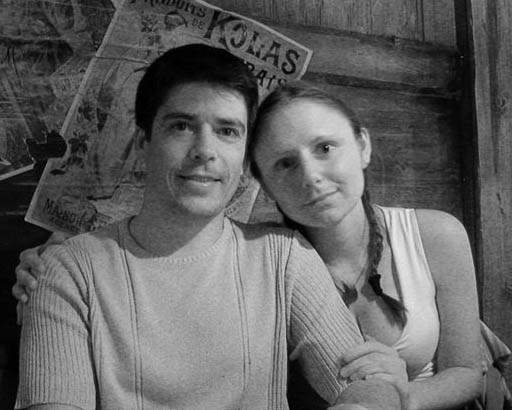
Around The World 2005

We "were" traveling around the world and we want to share part of this adventure with you on this blog. The updates have been quite late but we will put the trip until the end, so check once in a while. Some cities have an hiperlink to a .kmz file. That is a Google Earth location file. If you have Google Earth installed it will take you to the city when you click on its name.

Wednesday, November 30, 2005

El Choro - Bolivia

9/26/05

El Choro is a much more popular trail then the one we did the day before (Pico Austria). It is well marked, so a guide is not required. We went from La Paz to the start of the trail by cab; it took one hour and a half to get there. The area is called La Cumbre, from where we started walking. This trail starts at 4,700 meters and it finish after 3 days at 1,300. The differences in weather, temperature, and vegetation between the start and finish are extreme. The beginning was so cloudy that we couldn’t see much.


The way down is a pre-Hispanic Inca trail and there are some villages along it. The houses are very basic and made of stones.


We were walking inside the cloud, the sky pitch white.


In some parts the trail is made of Stones that become very slippery when it rains. Also we met local farmers traveling from one village to the other with their llamas.

lamas

At the end of the day we arrived at Chalapampa at 2,825 meters. It was raining but they had a shelter where you can set the tent under. There we met Claudio and Lurdes, two kids taking care of the campsite with their five brothers and sisters. Their parents are working at La Cumbre and they only see them once in a while. The closest school is two hours of walk away, in Chucura, and they only go there twice a week.

9/27/05

The second day the vegetation was already different. Whereas the first day was only stones, the second day was very green.

The trail was also more challenging since it was going up and down and the visibility better. We could finally see far in the valley.


Again on the way there were some houses, but this time not made only of stones, but of wood and straw.


From the top we saw the river ...


... and we had to walk all the way down to cross it.


Then we climbed all the way up again to camp at Bellavista from where as the name says we could enjoy a wonderful view. The snow you see on the picture is the beginning of the walk.


9/28/05
The third and last day wasn't too different from the second, beside the fact that it was shorter, only 3 hours of walk from Bella Vista to Chairo.

We first passed the the house of a Japanese guy living in the mountain for the last 30 years. Here is his house.


Then we reached Chairo from where we took a jeep to Coroico. From Coroico we caught a bus to La Paz through the so-called “world’s most dangerous road” due the high number of fatality in car accidents. The road goes along a very high cliff with no protection and lots of curves. In many parts of the road only one truck can pass.


There is no pavement so the dust is flying around and the heavy traffic makes it worse.


Thursday, November 17, 2005

Pico Austria - Bolivia

9/24/05
We left La Paz at 7:30 a.m. in a taxi with our guide for Cordillera Real, crossed the smoky and really spread out suburb and after nearly one hour of jammed traffic we got to a dirt path that leads to a place called Rinconada, where the trail starts.
From the dirt path there was an awesome view of the snow capped Cordillera Real and the fields with sparse countryside stone houses. In the distance we noticed cholitas spinning wool while watching for the sheeps.

During the whole trip we heard the guide and the taxi driver complaining about life and of how much they make. We were leery about our guide when he had to stop (several times) to ask locals for directions. The taxi driver got upset with the long way, bad road and uncertainty of destination and demanded more money to the guide (we paid the tour to the agency, so we were spared of hassling). When we arrived in Rinconada, in the middle of nowhere, ...


... the driver said he would not come back the following day to pick us up for the same amount. I had to give him the phone number of the agency and hope that he would have a better deal with the agency, or I don't know how we would go back to La Paz.

After that troublous start we followed with the plan and started the walk not sure if the guide knew the way.


The walk was quite short, some two hours, to the camp site where we arrived around noon. Nevertheless the way was really beautiful and we passed by two lagoons. The initial plan was to hike for 6-7 hours to the campsite, but somehow it got shorter.

Click here for a panoramic of the lake

At the campsite we had lunch and our useless guide said he was done for the day and that we could explore the area (on our own) if we wanted. Of course we wouldn't go to sleep at 1 p.m and went to walk around.

We walked to a glacier close to the campsite; on the way there were lots of lamas eating the weird grass that grows in the region.


We walked in the direction of the glacier on the right in the next picture.

Click here for a panoramic of the area

Soon we started to climb the mount in this fantastic environment.


When we were back at the campsite ...


... we found to have a nice couple from Boston as neighbors.

Click here for a panoramic of the campsite

We chatted for a while, they showed to us Condoriro, the peak they were going to ice-climb when suddenly, out of nowhere, a local girl showed up to sell souvenirs.


We had dinner, some hot tea and went to sleep. At night the temperature dropped to below zero Celsius :)

9/25/05
Around 3 a.m. we heard the Americans leaving to climb Condoriro, but we went back to sleep and got up only at 6 30 a.m. for breakfast; half an hour later we left to climb Pico Austria at 5,300 meters.


Since we had spent already more than a week at high altitude, the climb didn't seem that difficult and for each step up it was possible to see a bit more on the horizon.


It was very clear and we could see even the Lake Titicaca at the Bolivian-Peruvian border, but Titicaca is not the obvious lake in the picture, it is the one fading out on horizon.


Click for a panoramic

In every direction the view was outstanding. It was possible to see even La Paz.


From the top there was also fantastic views of the neighboring mountains and glaciers.

Click for a glacier panoramic

Click for a another panoramic

Click for a another panoramic

On the way back to the campsite, we stopped for lunch half-way down.


Then we reached the campsite and around 1 p.m we were ready and packed to go back to Rinconada and find out if our transport would show up or not.

In Rinconada we watched the locals fishing trout and waited some two and a half hours for a car to show up.
It wasn't the cab driver, no, it was the owner of TravelTracks on his own car.

Back in La Paz we had a conversation we TravelTracks about the guide and the taxi and it seemed that the guide messed up things. TravelTracks was grateful for our feedback, apologized for the trouble and, in compensation, gave us free transport from La Paz to the beginning of the trail El Choro for the following day.

Sunday, November 13, 2005

La Paz - Bolivia

9/23/05

La Paz is the world's highest capital with 3,636 but it spreads up to 4,000 meters. The population is over a million (8,8 millions in entire Bolivia) and mainly composed of native indians.


We spent only one day in La Paz because what we were really looking for in this region of Bolivia was trekking. The first thing we did was to find a travel agency to get information about trekking around La Paz.
We found a nice agency, TravelTracks, owned by a Dutch/Bolivian couple, where
we got all the info we needed and even more. The problem was the amount of choice and the little time we had. The Cordillera Real offers several trek possibilities, then there is the classic El Choro through an ancient Inca path, not to mention a dozen or more peaks to climb.

Not knowing what to chose, we decided to go for a walk in the city and come back after some reflection time. Our first stop was the super interesting Coca Museum, very small, but packed with info.

Here are some facts :

- Angelo Mariani, in France, invented the Vino Mariani in 1863 made with coca leaves. He achieved worldwide success for many years due to the stimulating effect of the drink. Several imitations were launched but the most successful one was from doctor John Pemberton's, pharmacists in Atlanta. He produced a drink called French Wine Coca containing coca, but also extract of a Ghanaian Cola nut which has a higher concentration of caffeine than coffee. With the prohibition in the US, alcoholic beverages were banned, so he had to change to formula to what is today the most recognized product: Coca Cola.

- Coca leaves have been used in South America by indigenous groups for over 4500 years.

- Due to the magical and religious role that coca leaves played, coca was considered satanic at first and an obstacle to Catholicism by the Spanish. Once it was discovered that chewing coca provided the slaves with more energy to work, it was sanctified and its consumption was even made mandatory by mine owners. The indigenous people worked 'days' of 48 continuous hours without adequate breaks or any food other than coca leaves to chew.

- The benefits of coca are used by pharmaceutical companies that discovered its anaesthetic power, by coca cola for the drink and by multi billion-dollar illegal cocaine industry, all controlled by foreigners, but Bolivia has been blamed for the western world's drug addiction problem.

After a cocaine shot (just kidding), we went to visit the Witches' Market, a famous and singular market in La Paz. The place is called like that because you find dried fetus of lamas and other animals...


... herbs, seeds, magical ingredients...


and other strange things supposed to be remedies for any combination of illness that you may be experiencing and protection from the bad spirits which whom according to Aymara beliefs, populate the world. The dried fetus is buried with different offers to Pachamama in front of a new house to protect it from the bad spirits. There are also prepared sets of offers to Pachamama.


The witches market is really small and since locals know that it attracts a lot of tourists, there is a souvenir market right next to it where the natives sell handcrafts and handmade weaving and knitted stuffs.


Before the end of the day we still made a stop to talk to the Clube Andino de Montanhismo, and see what info they had about trekking. It wasn't actually great but somewhat useful. The two people were really nice to us and helped us to buy gas for our trek and showed us the Market Rodrigues where we bought food to take with us during the trek.

Finally we decided to do a 2-day trek in Cordillera Real with TravelTracks (since the trails are not marked there) followed by a 3-day trek by ourselves in El Choro.

Saturday, November 12, 2005

Sucre - Bolivia

9/21/05
We were on the streets of Sucre by 9 a.m. It is as small relaxed clean town full of beautiful old buildings from colonial time.

The church at main square has a tower with 16 bells.


In the same square is the Palace of Justice, also very nice and well kept. Bolivia doesn't seem to have only one capital, although everyone think that La Paz is the capital Sucre has the seat of the whole judiciary system and is also listed as capital of Bolivia.


In the afternoon we visited the Museo Casa De La Libertad where an excellent tour is given on the political history of Bolivia. The museum is located in a building constructed by the Jesuits on the beginning of the 16th century for the Universidad de San Francisco. Also, in the same building, the independence of Alto Peru (Peru and Bolivia at the time) was proclaimed. The leader for independence from Spain was Simon Bolivar, a Venezuelan.


After the museum we adventured in the local market where we saw head of cows with eyes popped out for sale, but we have no idea how they prepare it. Then we went back to the main square and took our time on one of the many benches.
Lots of little boys approached us asking to shine our shoes. This is a very sad thing, because they should be either in the school or playing with their friends, but not working.

At the end of the day we went back to the hotel and met very nice and interesting people, Dan from Australia, Christian, a German doing social work in Argentina to avoid serving the army, and Peter&Mette a British/Norwegian couple also in a world tour trip. While chatting we tried many different local beers :)p

9/22/05
We had a long traveling day ahead of us. We left the hotel at 6 a.m. and took a bus back to Potosi, then at 11 a.m. we took another bus to Oruro and at 4:30 p.m. we took another bus to La Paz where we arrived at 7:30 p.m.
Along the way it was again a dry landscape with no vegetation and only a few villages here and there.


We stopped in one of the villages (probably a dozen of houses)where there were sellers sitting aside the main road.


On the last bus, to La Paz, we had lots of sellers, among them one was selling several kinds of medicines and another was selling books. The book seller caught our attention because he wasn't selling ordinary novels, no, he had the constitution of Bolivia, history of the wars of Bolivia and a Spanish grammar book.

Arriving in La Paz we saw the busy city, with the center in a hole and all the suburbs around on the hills.

Wednesday, November 09, 2005

Potosi - Bolivia

9/19/05
We left Uyuni for Potosi at 10 a.m. and surprisingly the landscape was very similar to the one in Altiplano. The road was a simple dirt path in the middle of the dry mountains. There was no plantations, no river, nothing. We just saw two small villages in which people live in very poor conditions.

Many houses were made with blocks of raw clay mixed with stones and dried by the sun. At each rain it melts a little bit. After 5 hours of trip we arrived in Potosi, a city at 4070 meters of altitude.

What they called 'the bus station' was actually just a corner on the street where we got off. The people living here really have an original and strong character.


Potosi was first a miners settlement at the bottom of Cerro Rico, a mount that proved later to have much more plata (silver) than expected; the temporary disorganized settlement became a town, still today, disorganized.

It received so many people that Potosi was on the 18th century the biggest city in South America, but of course most of the silver was sent to Spain and Potosi remained poor.

Walking around we saw lots of school kids. It seems that every school has its own outfit which consists of black pants for boys, a black skirt for girls and an apron whose color changes depending on the school.


At the end of the day we went to look for a restaurant for dinner and we found one with a great view of the city.


9/20/05
We visited La Casa de La Moneda where we had a very interesting guided tour through the big building that occupies a whole block and houses today not only the old machinery used to produce coins with the silver from Cerro Rico, but also paintings, mummies and samples of all kinds of minerals encountered in Bolivia. We also learned a lot about Bolivian and Spanish history.


One of the exhibitions had this awesome safe box used by the church to collect money from the people. It had a very sophisticated locking system with a fake key slot at the frontal face of the box to mislead any potential robber. It is not so easy to see on the picture, but note that the two openings to drop money are strategically placed at the hands of the figure of Jesus Christ. These safe box were then taken all the way to the church in Spain and they were open only there.


This painting is very important in Potosi and it describes not only local life but how the church did to christianize the local Indians. Because the main god was Pachamama (Mother Earth), the church ordered to paint Cerro Rico which represents the traditional conical figure of the Virgin Mary. On the top of it are the religious Christian authorities and the king of Spain. In smaller importance, and size, are on the left the sun, and on the right the moon, also considered gods by the local Indians, whom are depicted mining the Cerro under the protection of Virgin Mary.


We then walked around the city and admired the old remaining colonial buildings.


There are many stores like this, you can't get in, there is a fence on the door and you must order from outside.


The square was full of cholitas, the name given to the women dressed the traditional way. They sell salteñas (a salty pastry with a meat filling), juices and other little things.


We saw a parade with kids dressed with different traditional clothes. They were celebrating the 'student day', day on which they parade and party.


We walked all the way to the new part of the city...


... and went back to the bus station to buy a ticket to go to Sucre. On the way there are people selling fruits just like this.


At the end of the day we travelled to Sucre.